Precision Aerial Imaging & Geospatial Solutions
Successful aerial data or footage acquisition is a complex endeavor, demanding more than merely an aircraft. It requires meticulous mission planning, seamless sensor integration, and precise regulatory compliance. Helicopters Over Madison serves as your expert mission facilitator, managing the entire process for projects across Wisconsin. We meticulously assess your specific data or footage requirements, facilitate access to the optimal airframe and highly experienced aviation specialists best suited for that profile, and expertly manage all necessary flight planning, permits, and clearances. This comprehensive approach provides you with a single point of accountability and a truly turnkey, efficient result.
Cinema & Broadcast Videography
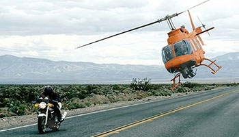
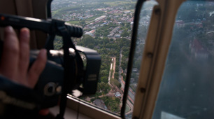
For high-stakes visual projects, from feature films to dynamic live broadcast events, we facilitate access to exceptionally stable, high-performance aerial platforms. These are specifically tailored to meet the demanding requirements of Directors of Photography and production crews operating in the Madison area and beyond. We seamlessly support industry-standard stabilization systems, including Shotover, Cineflex, and Tyler Mounts, ensuring flawless integration and coordinated execution with your team for truly perfect, cinematic shot acquisition.
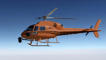
Aerial Photography
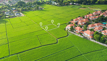
Elevate your visual storytelling with high-resolution marketing assets, compelling real estate portfolios, and precise progress documentation. Our aviation specialists possess a deep understanding of lighting, angles, and composition, ensuring the delivery of magazine-quality aerial stills that capture your project's essence across the Madison region.
LiDAR & Geospatial Surveying
We provide advanced geospatial data solutions beyond standard visual imaging. This includes precision LiDAR acquisitions, detailed orthomosaic mapping, and comprehensive 3D terrain modeling, vital for sophisticated urban planning, critical utility inspections, and robust environmental monitoring projects across the Madison area.
Utility & Asset Inspection
For rapid and highly detailed inspections of vital infrastructure like transmission lines, pipelines, and cell towers, we offer unmatched stability. Our helicopter solutions deliver the precise hover capabilities essential for high-fidelity asset auditing projects throughout Wisconsin.
Technical FAQ
Our helicopter platforms are expertly configured to accommodate all leading industry camera mounts, such as Shotover (F1, K1), Cineflex, and Wescam. For projects requiring lighter cinema payloads, we seamlessly integrate Tyler Minigyro and Middle mounts.
Absolutely. We manage all necessary airspace authorizations and meticulous flight plans for urban aerial photography operations, including those over downtown Madison. The highly experienced aviation professionals we coordinate are adept at navigating complex controlled airspace, ensuring your required imagery is captured legally and safely.
We offer a comprehensive, turnkey solution, providing a skilled sensor operator as needed, or seamlessly accommodating your creative team. Should you bring your own crew, we conduct thorough briefings on all essential safety and precise air-to-ground coordination protocols for optimal mission success.
Leveraging advanced sensor payloads, we deliver diverse data outputs including raw point clouds (LAS/LAZ), high-resolution orthomosaic maps (TIFF/ECW), or expertly processed 3D meshes. We collaborate closely with your GIS team to guarantee seamless file compatibility and integration.
Gallery
Aerial Photography
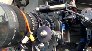
Camera Equipment
Camera Mounts
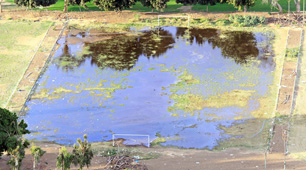
Damage Survey
Real Estate Survey
Aerial Videography
Your Comprehensive Aerial Photography & Videography Partner in Madison
Connect with Helicopters Over Madison at 1-855-445-8965 for a prompt, no-obligation quote for your next helicopter aerial photography project in the Madison region.